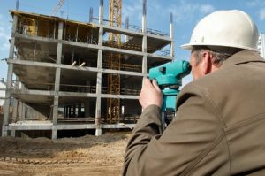
Large-scale infrastructure projects take plenty of time and preparation to complete. Whether it involves the construction of highways, bridges, commercial developments, or industrial complexes, land surveying is an important part in the process of getting these projects accomplished with efficiency and accuracy. Without accurate, comprehensive, and detailed surveying, projects can face significant delays, cost overruns, and potential legal disputes.
Defining Boundaries and Ownership
One of the fundamental roles of land surveying is to establish clear property boundaries and ownership rights. This is crucial for large-scale projects that often span multiple parcels of land, involving various stakeholders. Boundary surveys help identify the exact extent of land ownership, preventing disputes that could otherwise arise and disrupt project timelines.
Topographic Data for Informed Planning
Topographic surveys provide essential data on the natural and man-made features of the land, such as elevation, slope, and existing structures. This data helps engineers and architects design infrastructure that harmonizes with the terrain, minimizing costly modifications and unforeseen challenges.
Supporting Construction Layouts
Land surveyors play a key role in staking out the exact locations where construction activities will take place. This ensures that the infrastructure is built according to the design specifications, avoiding costly rework.
Hydrological Surveys and Flood Risk Management
Hydrological surveys assess the presence and behavior of water on the site, ensuring that drainage systems are appropriately designed to handle rainwater and prevent flooding. This is essential for the long-term viability and safety of the project, as inadequate flood management can lead to infrastructure damage and safety hazards.
A Foundation for Future Development
The data collected through land surveying doesn’t just benefit the current project—it lays the groundwork for future development and expansions. Accurate land records ensure that any subsequent construction or land use planning can proceed smoothly with an established baseline of information.
BLAZE Design Inc. specializes in comprehensive land surveying services, ensuring that your infrastructure project is built on a solid foundation. With expertise in boundary, topographic, hydrological, and construction layout surveys, we support developers and project managers in bringing their visions to life smoothly and efficiently. Contact us today at 802-442-2892 for more information!
